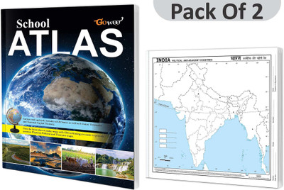
SCHOOL ATLAS (ENGLISH) - MAPLITHO And SMALL - 100 INDIA POLITICAL OUTLINE MAP FOR SCHOOL I Combo Of 2 Charts I Students Best Geography Companion(Paperback, GOWOO)
Quick Overview
Product Price Comparison
"""The ""School Atlas (English) - Maplitho"" and ""Small - 100 India Political Outline Map for School"" combo is the ultimate toolkit for comprehensive geography education in schools. This powerful combination offers a complete set of resources to enhance students' understanding of both global and regional geography. The ""School Atlas (English) - Maplitho"" is a comprehensive atlas that presents a detailed overview of the world with high-quality maps, including thematic maps, topographic features, and informative content. It enables students to explore the diverse landscapes, cultures, and environments of different countries, fostering a deeper appreciation for the world's interconnectedness. Complementing the atlas is the ""Small - 100 India Political Outline Map for School,"" which focuses specifically on the political boundaries of India. This compact and meticulously outline map helps students grasp the country's political divisions, including states, union territories, and significant cities, enhancing their knowledge of India's political geography. These resources provide students with a holistic understanding of global and regional geography. Whether used in the classroom or for individual study, this combo supports comprehensive learning and promotes a deeper appreciation for the diversity of our world. Invest in the ""School Atlas (English) - Maplitho and Small India Political Outline Map Combo for Comprehensive Geography Education"" to equip students with the necessary tools to become knowledgeable global citizens. This combo is essential for educators, geography enthusiasts, and students seeking a comprehensive and visually engaging exploration of the world and India's political landscape. """


