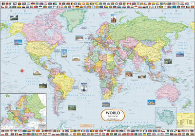
World Political Map Paper Print(28 inch X 40 inch, FOLDED)
Quick Overview
Product Price Comparison
This laminated World Map is certified by Survey Of India and has been fully updated to include the latest political changes, and contains politically coloured mapping showing all countries, their capital city, major air and sea routes and important cities and towns clearly. Also included are national flags of prominent nations, new seven wonders of the world and inset map of Europe. This map is thermally laminated on both sides making it tear & water resistant This Map is ideal for any classroom, bedroom or office wall. INCLUDES: ├»ß╣Īß║ä├»ß╣Īß║ä├»ß╣Īß║ä All recent political changes including the new independent country of South Sudan ├»ß╣Īß║ä├»ß╣Īß║ä├»ß╣Īß║ä Changes to international dateline AREA OF COVERAGE All of the world, centred on the Greenwich Meridian, and including an inset map of Europe. SCALE 1 : 32,000,000 SIZE 100 x 70 cm (28 x 40 inches)


